cover photo by
Fabrizio Fortuna
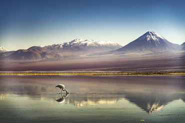
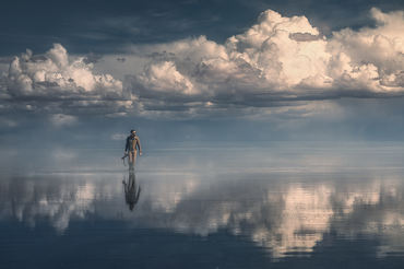
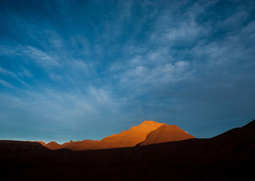
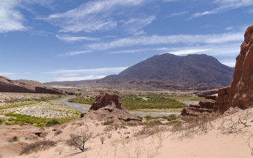
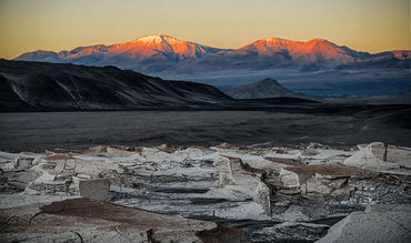
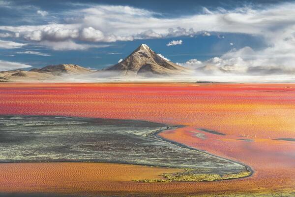
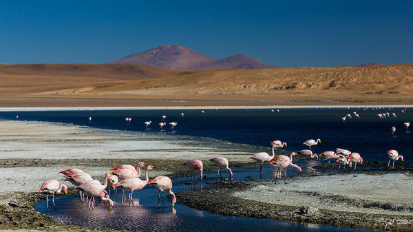
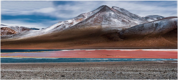
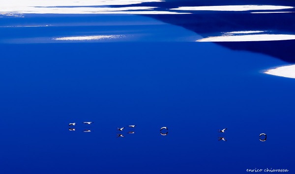
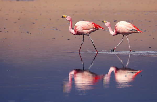
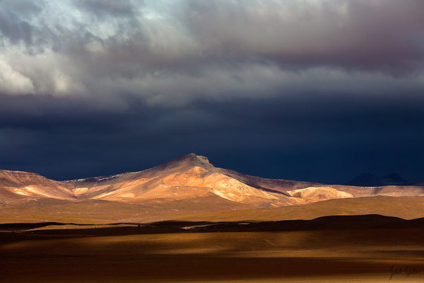
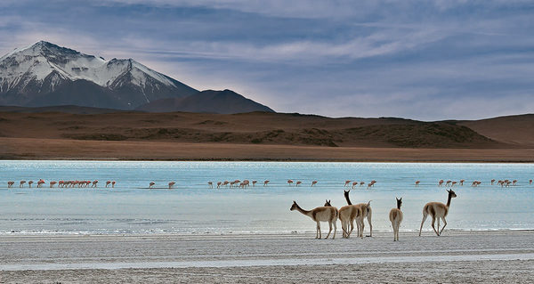
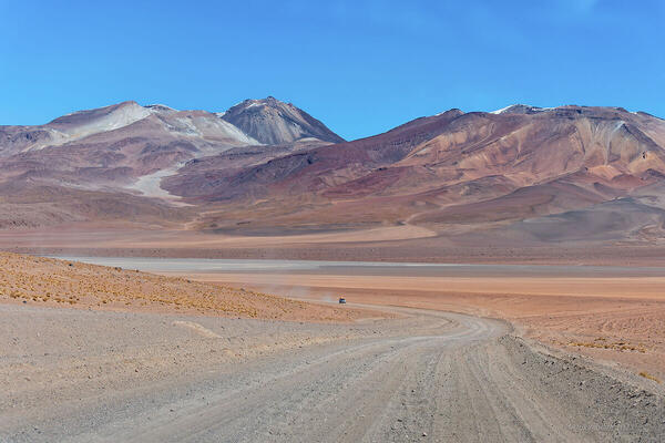
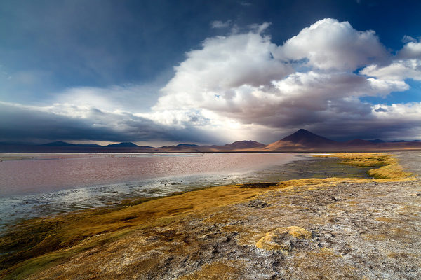
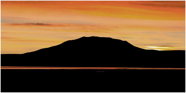
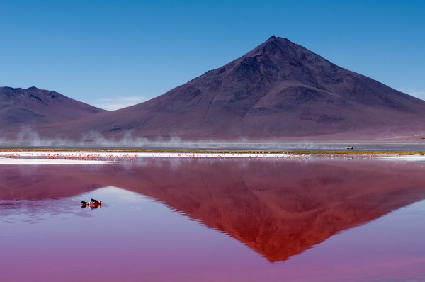
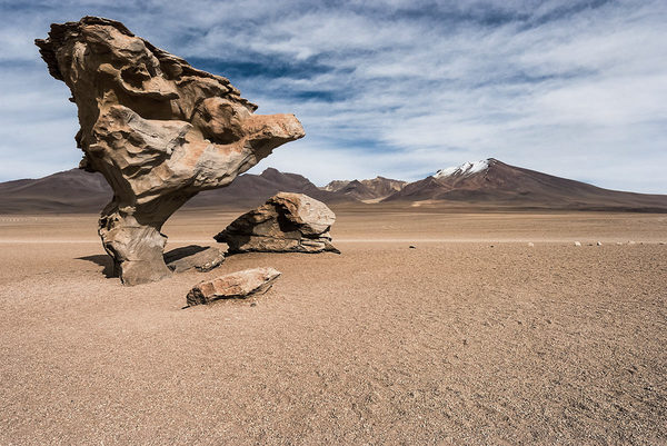
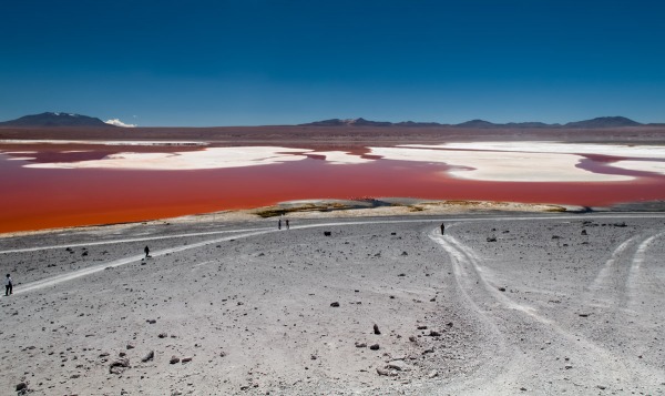
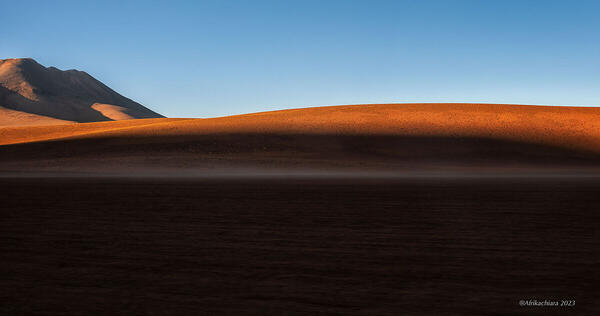
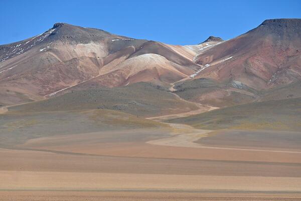
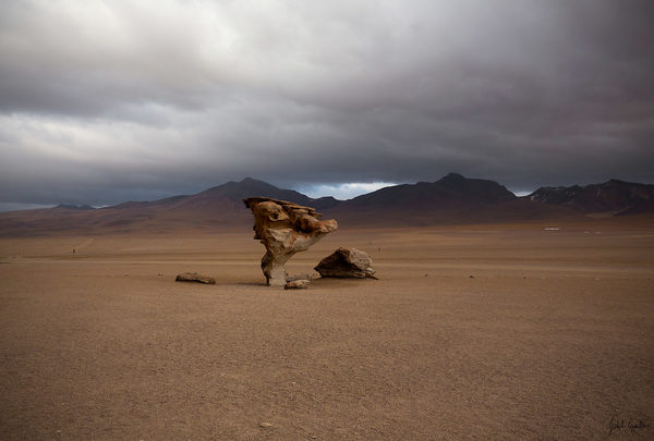
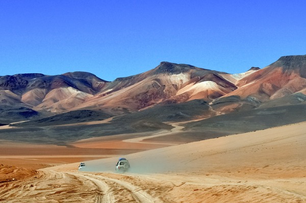
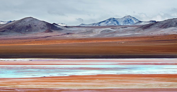
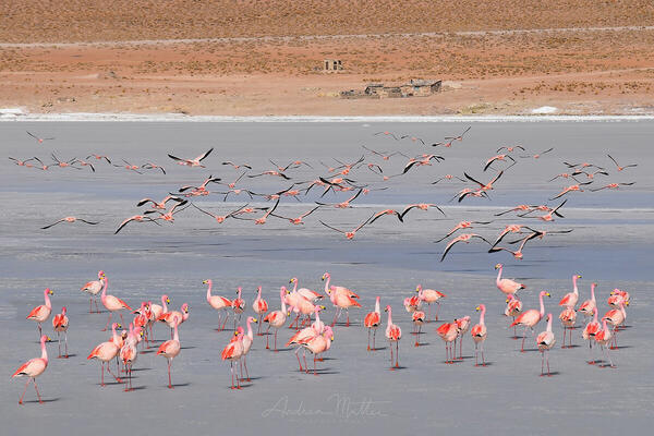
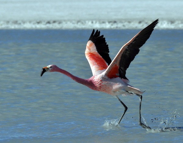
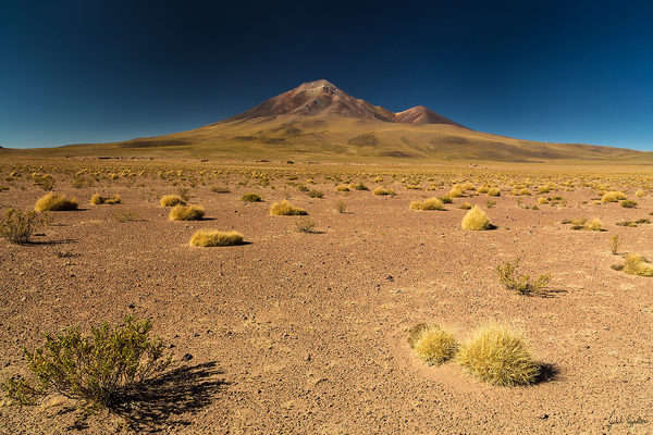
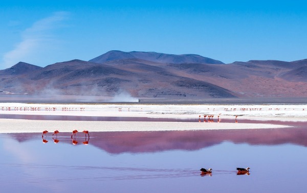
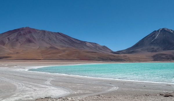
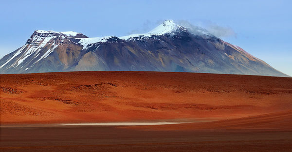
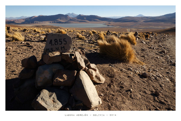
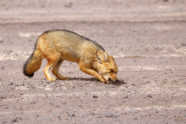
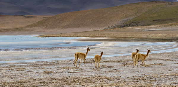
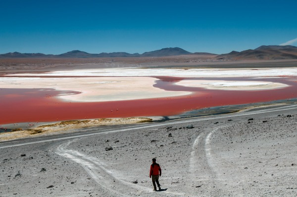
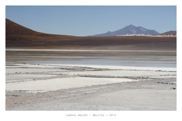
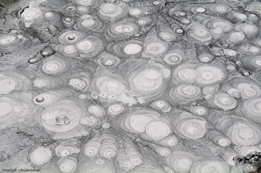
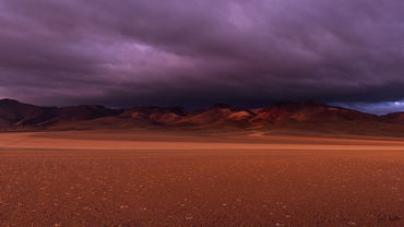
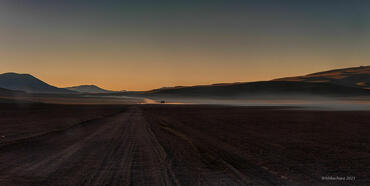
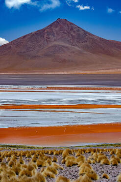
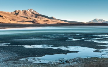
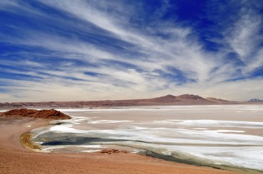
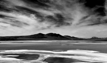
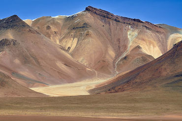
 The information about this location have been automatically translated with Microsoft Translator. The information about this location have been automatically translated with Microsoft Translator. Rank : 10.0 (average on 5 votes)Coordinates : -21.813058, -67.854767 ( Open in Google Maps) Subjects : Beautiful and evocative landscapes (between 3500 and 6000 meters): the salt desert of Uyuni (the largest in the world) with rocky islands covered with giant cacti (the oldest is dated 900 years!), High deserts, volcanoes active (the most famous is the Licancabur) and snow-capped mountains with amazing pastel colors, spectacular lagoons with colors ranging from blue to green to white to pink to deep red and for the dissolved salts and algae, which change color according to the time and to light. And then thousands of pink flamingos and Chilean (typical for the beak stained black) and other birds. In some areas persenza llama, vicuna and guanacos. Small villages or rifigi with authentic locals and still untouched by tourism. Geothermal areas with geysers, fumaroles, boiling pools of magma, geysers.Recommended equipment : From wide angle to telephoto, tripod, polarizer, various filters ... Having regard to the possibility of having different subjects: landscapes, birds and animals, portraits, travel reportage ...Best months : The best time is spring (October, November, December) to avoid excessive heat or cold. I was at the beginning of November, which corresponds to our spring, and early in the morning it came below zero, taking into account the altitude.How to get there : Buenos Aires fly to Salta, northwest Argentina. It continues through the Bolivian border on the road to Villazon. From there take the train to Uyuni on a railway line crazy and fascinating gorges and canyons more than 4000 meters above sea level. Upon arrival in Uyuni transfer to nearby Colchani and slept at the hotel made entirely of salt. The next morning departure for the Ruta los Desiertos from Colchani to get to San Pedro de Atacama. You take off-road and local guides are indispensable, because the journey has black spots over the possibility of getting lost. From San Pedro de Atacama return to Salta through Chile-Argentina border, closing the loop route.Visits : There are no entrance fees. There are no charges and checks at border crossings, in addition to renting the jeep with the guides.Notes : Bolivia is its plateau, and one of the least explored and most virgin of our planet, but it is the poorest country in South America, far back, in the most remote accommodation facilities are comparable to shelters or hostels rather than hotels, and are rather spartan, the local power supply is poor and there are no restaurants and toilets for so many miles. The route recommended "solo para Valientes", as the locals say. The crossing it takes place in an isolated environment, with high temperature and at high altitudes. It would not hurt a "check up" doctor before your trip in addition to drugs for those who suffer evil offshore. Earnings: hat, goggles, gloves, socks, boots, jacket wind, the rain cape, stack, toilet paper, soap, creams, sun creams, lips, medicines, disinfectants, repellent (some items you can buy in Argentina before enter Bolivia not to increase the weight of the luggage)
CalendarSunrise: 06:46, Sunset: 18:13 Show Sunrise and Sunset Calendar Discussion3 replies Read the discussion Moon Phase🌓 First Quarter, Brightness: 32% Show Moon Phases Calendar |
Nearby:  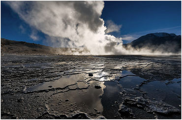 Gayser del Tatio 59 km
 San Pedro de Atacama 127 km
 Salar de Uyuni 184 km
 Los Colorados 319 km
 Quebrada de las Conchas 510 km
 Campo de Piedra Pomez 535 km
|


 JuzaPhoto contains affiliate links from Amazon and Ebay and JuzaPhoto earn a commission in case of purchase through affiliate links.

