cover photo by
Nicola De Crecchio
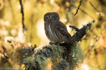
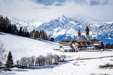
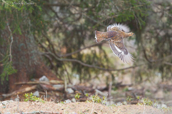
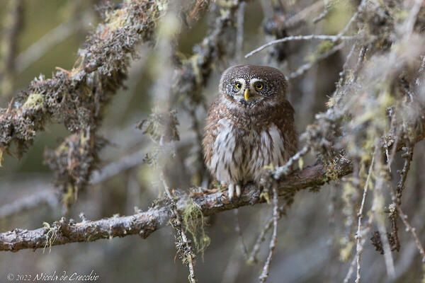
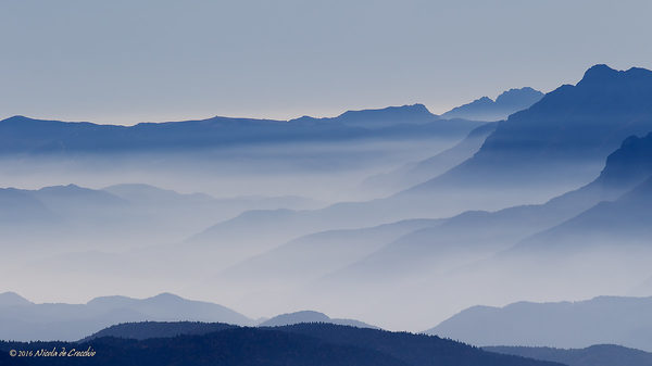
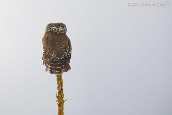
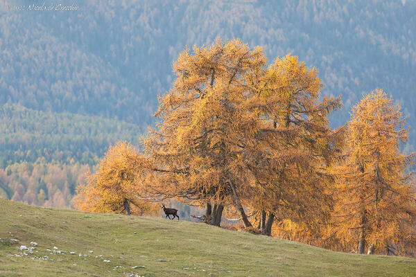
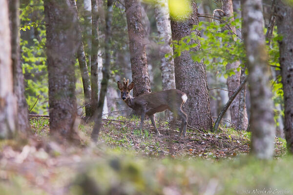
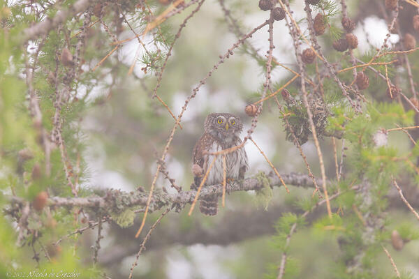
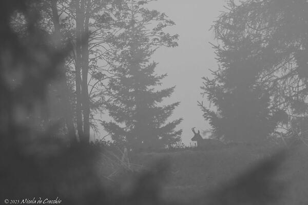
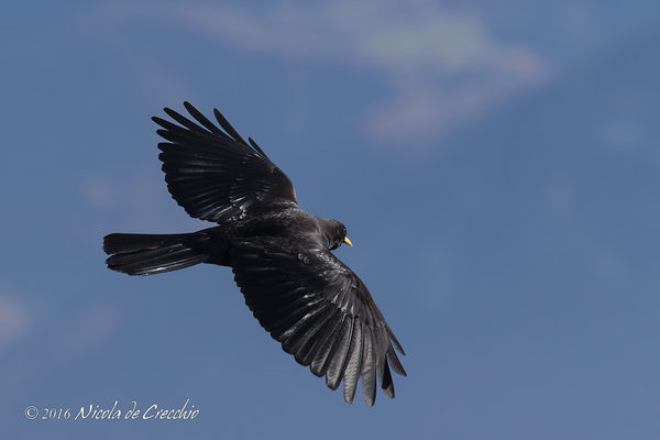
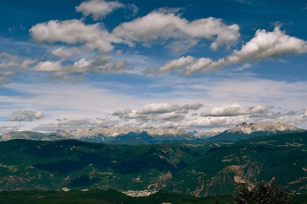
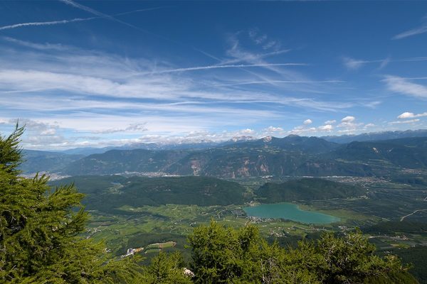
 The information about this location have been automatically translated with Microsoft Translator. The information about this location have been automatically translated with Microsoft Translator. Rank : 8.0 (average on 1 votes)Coordinates : 46.359999, 11.192224 ( Open in Google Maps) Subjects : Mount Roen is the highest peak (2116m) of the ridge that separates the Val di Non from the Val d'Adige and from its top you can enjoy a great 360 ° (Sassolungo, Catinaccio, Marmolada, Latemar, Pale di San Martino , Lagorai, Brenta Dolomites and Maddalene to name only the main visible mountains groups). E 'can also see the flora, fauna and birdlife Alpine; at the top it is almost always present the alpine chough.Recommended equipment : From wide-angle to telephoto for landscapes for birds. A telephoto lens is also useful for isolating certain areas of the landscape and create targeted compositions. It can also be helpful to have binoculars to better observe in the distance.Best months : All year: -In the late spring, after the snow melts, it is possible to admire a splendid flowering, -in summer, especially after a storm, you can see clear landscapes and enjoy a little 'coolness, -in autumn they can find wonderful days embellished with golden colors of the larches as they prepare for the winter, -in the winter and early spring can be beautiful snowy landscapes.How to get there : It goes up only on foot and the main access route is the path CAI 500 that starts from Malga Romeno: less than an hour, in altitude 350m without difficulty allow you to reach the summit. The Hills of Romanian you can arrive by car along a road that starts from the town of Amblar and is paved except the last part; alternatively you can reach the Malga Romeno walk (about an hour and a vertical drop of 150m) from Mezzavia haven that served as a chairlift near the pitch Mendola.Un'altra access road that provides a path short walk (30 'Height gain 200m) starts from Malga of Smarano and Sfruz; Here, however, the access road, traveled by car, however, is much steeper and stretta.Per the more adventurous you can also climb to the summit through a via ferrata that is after the Refuge Oltradige (15 'walk from Romanian Malga) .in winter access roads to pastures are not cleaned and therefore you should use the chair lift from Passo Mendola; usually the path is pretty beat and you can go up, even in the presence of snow, with only boots, however it is just snowed necessarily need snowshoes.Visits : Access is free, without schedulesNotes :
CalendarSunrise: 05:22, Sunset: 21:11 Show Sunrise and Sunset Calendar DiscussionNo replies Read the discussion Moon Phase🌓 First Quarter, Brightness: 40% Show Moon Phases Calendar |
Nearby:   Egna 8 km
 Lago di Favogna 9 km
 Canyon Rio Sass 9 km
 Lago Santo trentino 18 km
 Monte Peller 18 km
 Nova Ponente 18 km
|


 JuzaPhoto contains affiliate links from Amazon and Ebay and JuzaPhoto earn a commission in case of purchase through affiliate links.