cover photo by
Alberto Dall'oglio
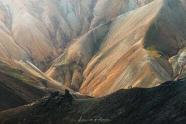
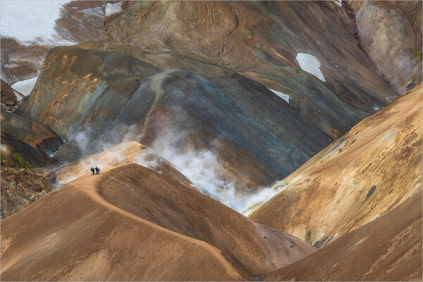
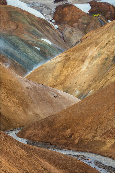
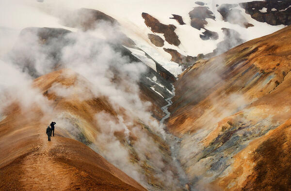
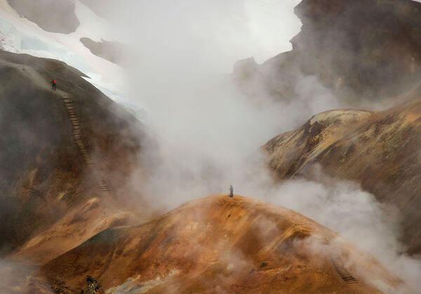
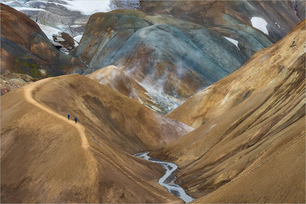
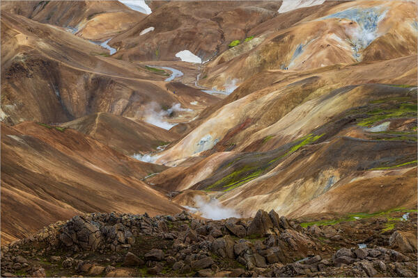
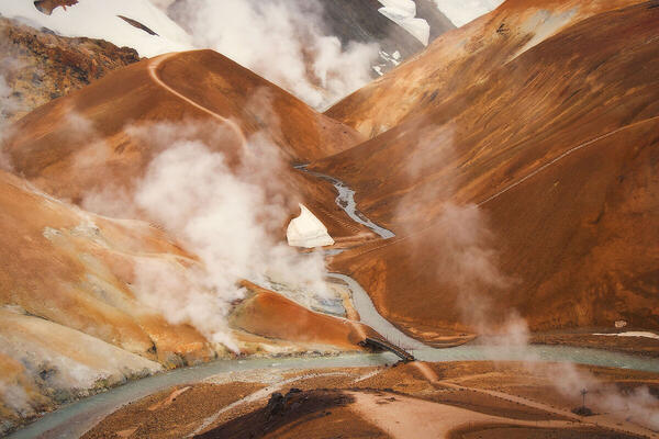
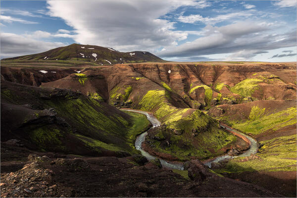
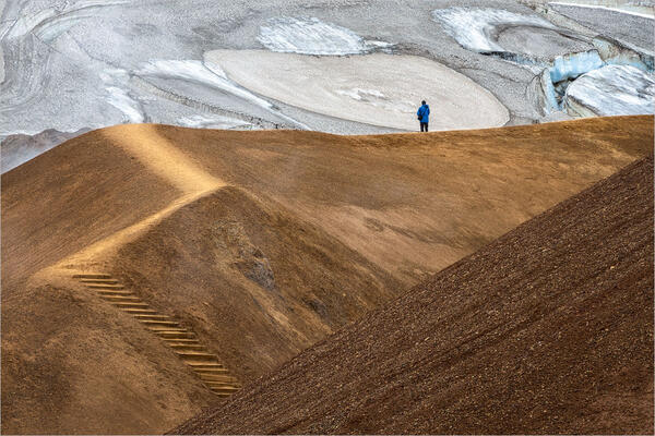
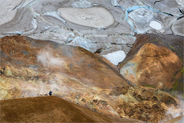
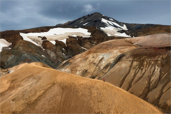
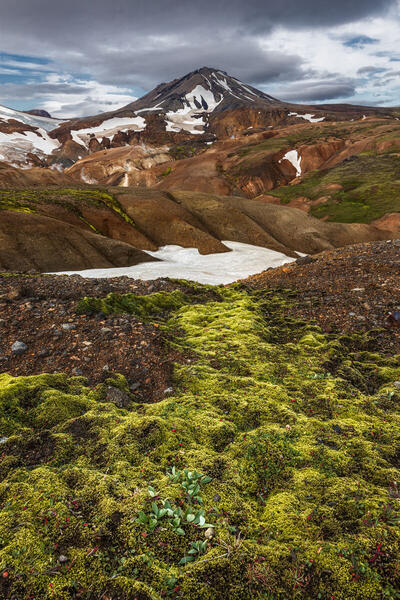
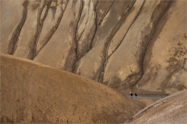
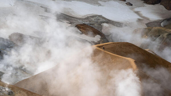
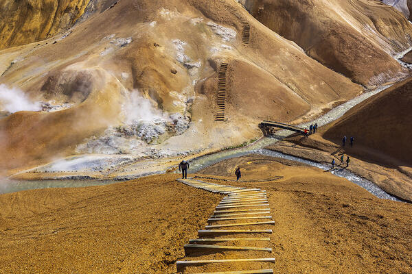
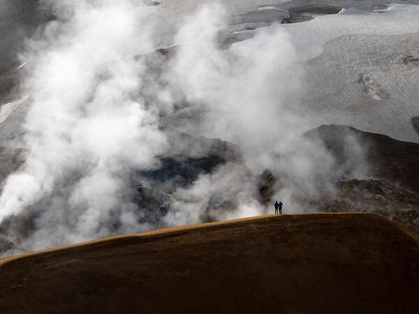
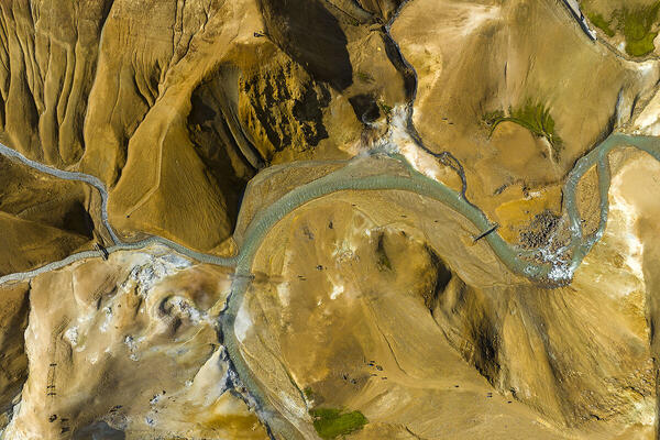
 The information about this location have been automatically translated with Microsoft Translator. The information about this location have been automatically translated with Microsoft Translator. Rank : 10.0 (average on 2 votes)Coordinates : 64.644688, -19.285512 ( Open in Google Maps) Subjects : Kerlingarfjöll is a small but stunning mountain range, created by a volcanic eruption about 10,000 years ago, located deep in the Icelandic highlands: among these snow-capped peaks is the Hveradalir geothermal area, which means "valley of hot springs" in Icelandic, a small valley of red rhyolite mountains, steaming springs and bubbling rivers. This area remained shrouded in mystery and popular belief for centuries that it was the home of notorious outlaws and trolls. In July 1961 the first group of tourists arrived in Kerlingarfjöll to practice skiing; At that time, snow covered the entire area even during the summer. Since the 2000s in Kerlingarfjöll there has been less and less snow in summer and today the area is known for the wonderful variety of its landscapes and since 2017 the area has been declared a protected nature reserve. The beautiful volcanic rhyolite mountains with colors ranging from ochre to blue are the main subjects of this area, interspersed with hot springs, fumaroles, rivers and snowfields that give this environment a surreal and wonderful appearance. Walking along the paths that wind through valleys and ridges, the shooting points are countless: you risk stopping at every step! The people dotting these grandiose scenery are often included in the shot because they bring a sense of wonder and alienation to the landscapes.Recommended equipment : The wonderful views of the Hveradalir geothermal area can be photographed with different lenses ranging from wide-angle to telephoto, but it is the latter that allows you to isolate portions of the landscape and obtain almost surreal shots. Although the tripod is always the faithful companion of a landscape photographer, in this case it risks becoming an obstacle and dangerous because you are often on steep ridges and narrow steep paths, as well as significantly lengthening operating times; for this reason, it is better to shoot handheld with stabilized lenses or bodies. Being a protected area (and frequented, even if it is easy to find your own "size") it is forbidden to use the drone, unless you ask the park authority for a permit against a cost that is not really within everyone's reach; In any case, aerial photography would not add much to this place which, being characterized by the many heights, allows you to have many elevated shooting points.Best months : Being in the Icelandic Highlands, the area is accessible independently only a few months a year and only in summer (from June to September approximately); in fact, in the remaining months it is covered with snow and very cold, so it can only be reached with tours organized by the locals in superjeeps, even if the snowy landscape completely loses the fantastic colors of the mountains that are the real attraction of these places.How to get there : Hveradalir is about 55 kilometers from the Golden Circle and can be reached by car, compulsorily 4×4 to be able to travel the famous F-roads, or Icelandic "mountain roads", dirt and often full of stones and potholes. From Gullfoss, Route 35 becomes an F-road (F35): the first part of the mountain road is quite beautiful, but after a few kilometers it becomes unpaved, bumpy and full of potholes. Follow the F35 until you reach the signposted turn for the F347. This road leads first to the Kerlingarfjoll Mountain Resort and then to Hveradalir. The last stretch (5 km) to the Hveradalir geothermal area is challenging, quite steep, rocky and bumpy. On a positive note: along this route there are no rivers to ford by car. You can park directly in front of the geothermal area: 64.64653442523226, -19.278438026781675.Visits : Parking is free and even the geothermal area itself does not have any entrance fee. There are no opening hours, but it is not recommended to go if the weather is adverse, as it is a very cold and windy area, even in summer.Notes :
CalendarSunrise: 02:36, Sunset: 00:04 Show Sunrise and Sunset Calendar DiscussionNo replies Read the discussion Moon Phase🌕 Full Moon, Brightness: 96% Show Moon Phases Calendar |
Nearby:  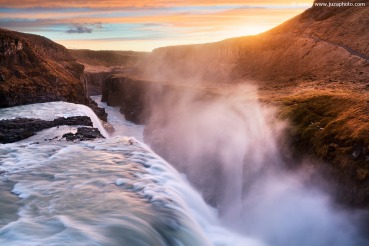 Gullfoss waterfall 53 km
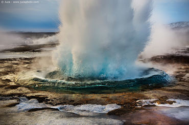 Strokkur geyser 65 km
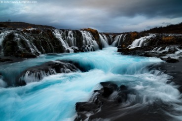 Bruarfoss waterfall 72 km
 Landmannalaugar 73 km
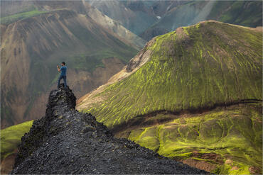 Bláhnúkur 74 km
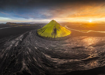 Maelifell 95 km
|

 JuzaPhoto contains affiliate links from Amazon and Ebay and JuzaPhoto earn a commission in case of purchase through affiliate links.