cover photo by
Gabriele Netti
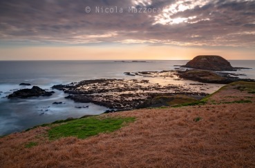
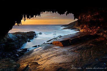
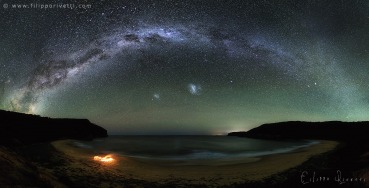
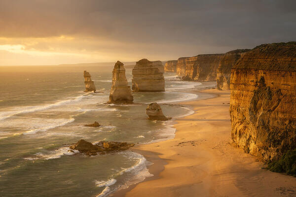
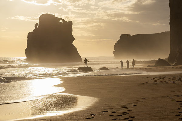
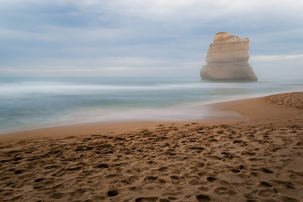
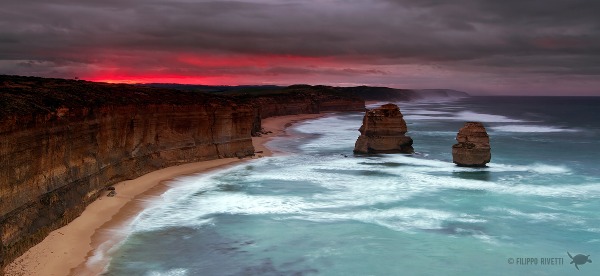
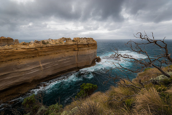
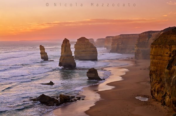
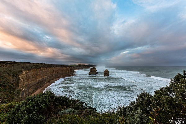
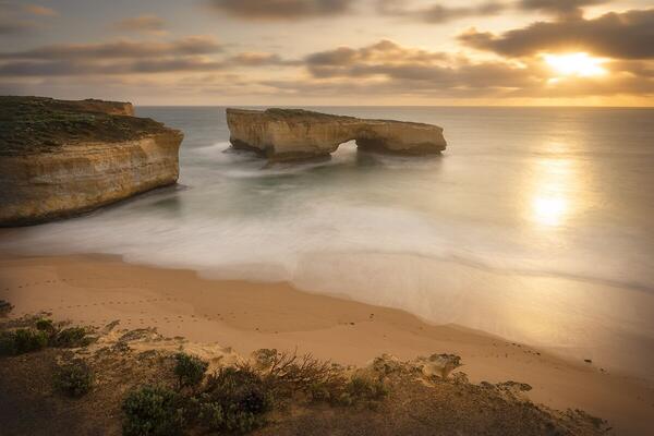
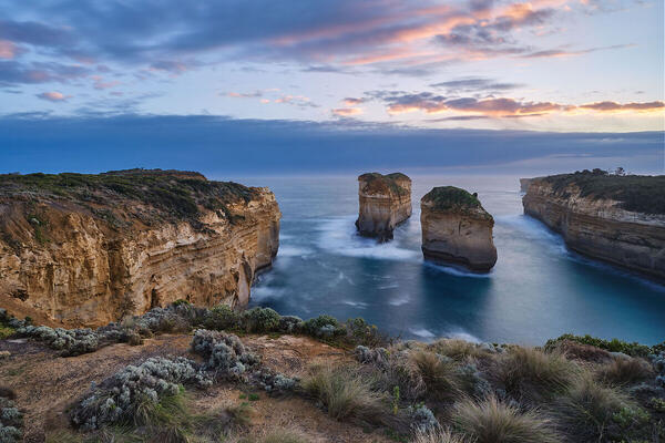
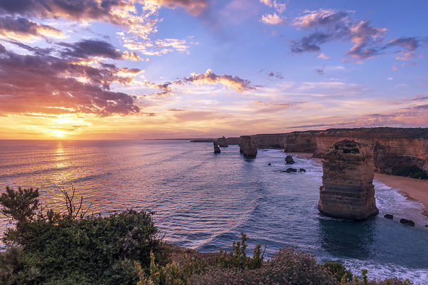
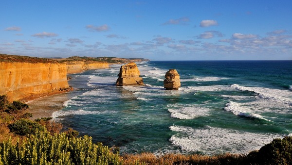
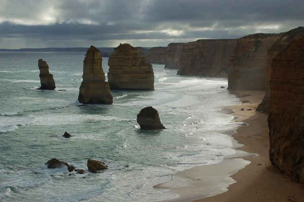
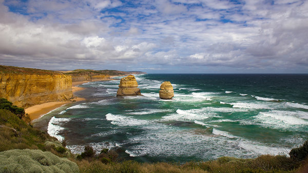
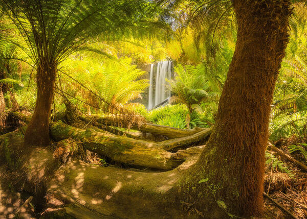
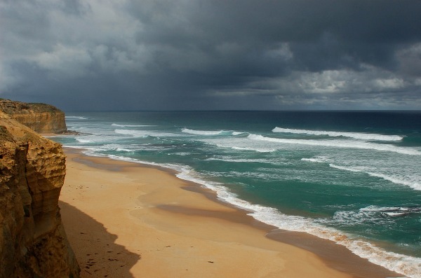
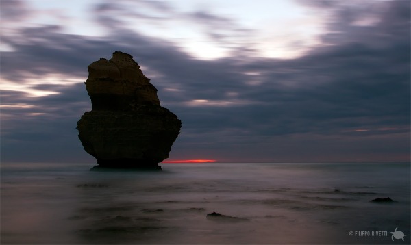
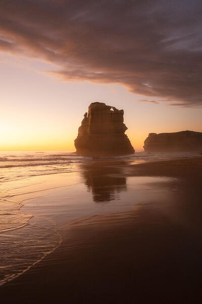
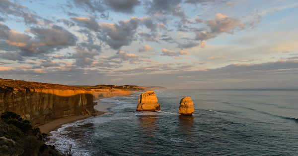
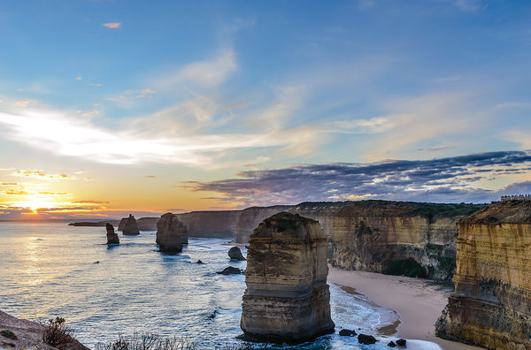
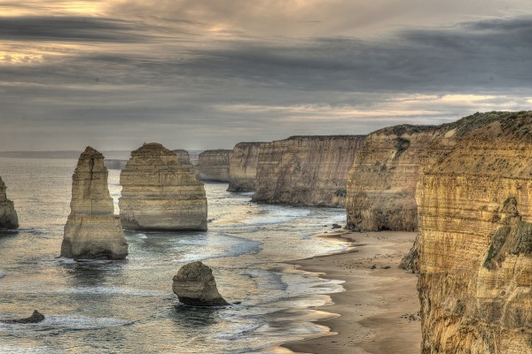
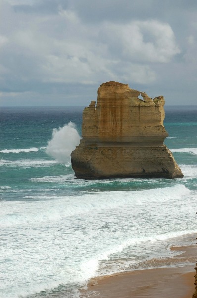
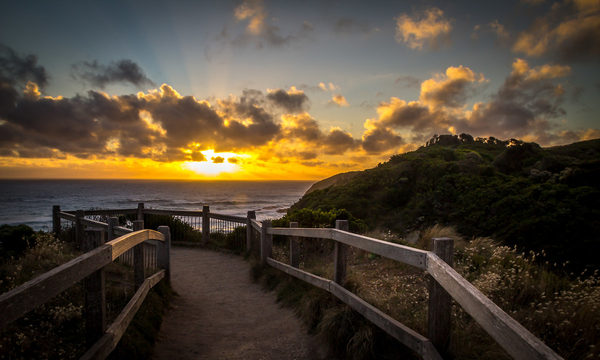
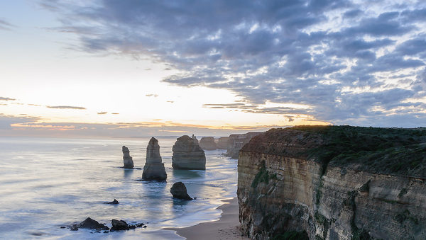
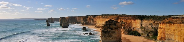
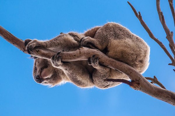
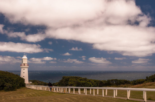
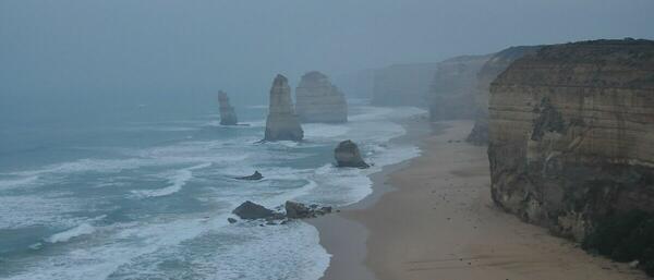
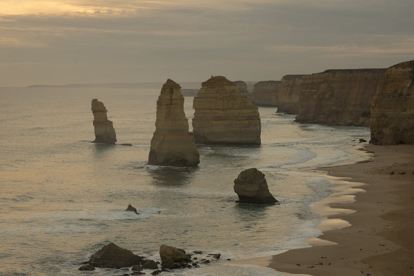
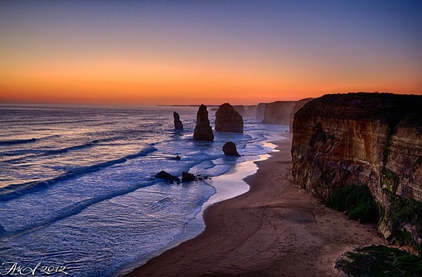
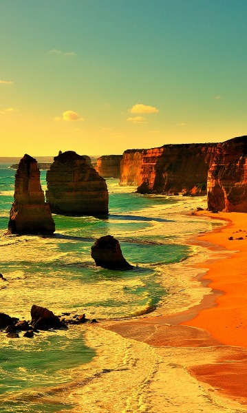
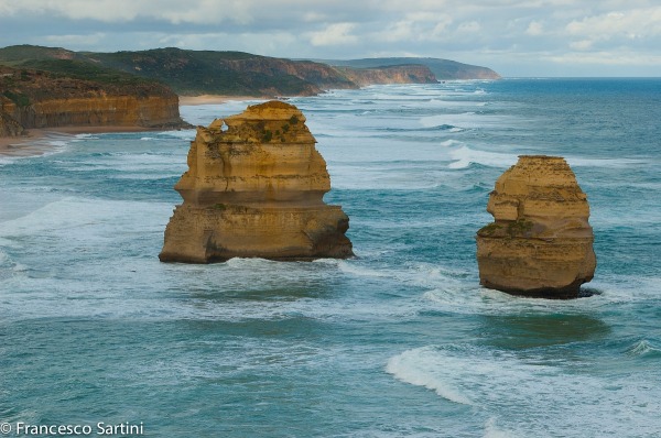
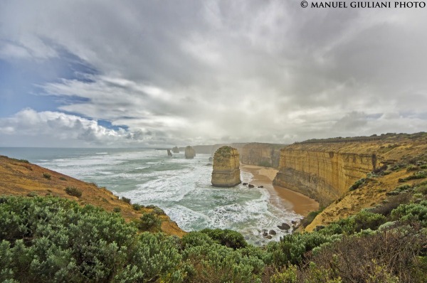
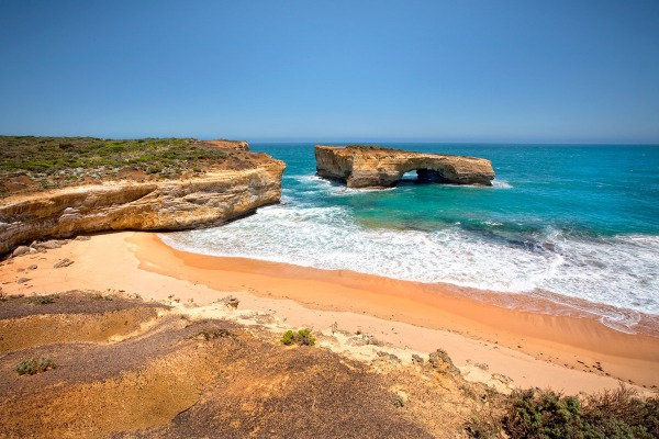
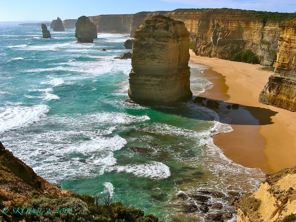
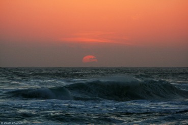
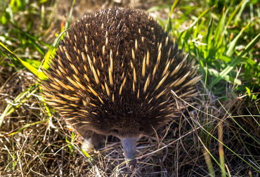
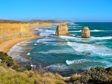
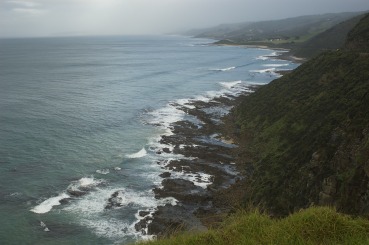
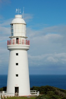
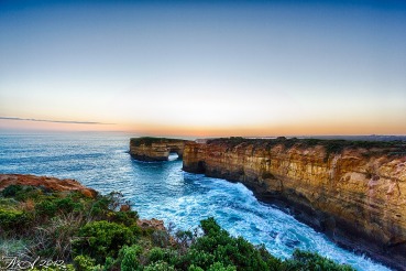
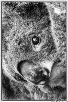
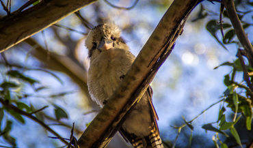
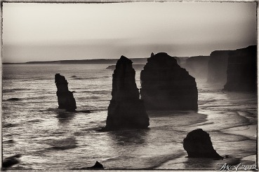
 The information about this location have been automatically translated with Microsoft Translator. The information about this location have been automatically translated with Microsoft Translator. Rank : 9.5 (average on 15 votes)Coordinates : -38.697702, 143.150113 ( Open in Google Maps) Subjects : The Great Ocean Road is a stretch of road about 250km situated between the towns of Torquay and Warrnambool in the region of Victoria (Australia). Along the way the road looks for much of the ocean, a continuous succession of steep cliffs, beautiful beaches, bays and coves carved by the sea in coastal rock. The most famous area is that of the "Twelwe Apostoles", located near Port Campbell, where you can see many giant rocks in the sea, staccattesi from the coast as a result of the powerful erosion of the ocean. Along the way there are also several "lights" warning for ships, such as the Cape Otway (within a lush national park) and the Split Point, near Aireys Inlet (very beautiful and can be visited inside, the summit provides sweeping views of the coast). Along the road leading to the lighthouse at Cape Otway is a forest where you can see many eocalipti Koala, which also often cross the road. (Prudence driving!). Do not miss the Museum of Surfing at Torquay, waterfalls Erskine Falls in Lorne, the Flagstaff Hill Maritime Village and all the places indicated by guides and maps can be found in the information centers located in almost all the villages through the Great Ocean Road. A Warrnambol there is a place where you can spot whales, often stationed in the bay in front of the town.Recommended equipment : A good wide angle for landscapes, a remote for the details and for animals that meet, Koala, Kangaroo, various birds. Good tripod for sunsets, creative photos with morning mists, waterfalls, waves crashing on the rocks.Best months : In summer (December February) good days, but a lot of people in the locality 'of the sea. In winter weather worst but very few people. (Recommended for photos, there is no one around, with all the advantages of the case)How to get there : The Great Ocean Road is located between Melbourne and Adelaide (about 1100 km). It takes at least three days to complete the course with a car or campervan hire, bearing in mind that the section is full of attractions between Lorne and Warrnambol (about 250 km), so you should expect more time in this area. The road is good, but the stretch full of beautiful curves and a max speed of 50/70 km / h, so you must calculate the good times and the stops to make.Visits : It 's all "free", except for visits to the "beacons" that are paid and museums (eg Museum of surfing in Torquay). 17 to close, like almost all public places in AustraliaNotes :
CalendarSunrise: 07:39, Sunset: 17:12 Show Sunrise and Sunset Calendar DiscussionNo replies Read the discussion Moon Phase🌖 Waning Gibbous, Brightness: 74% Show Moon Phases Calendar |
Nearby:  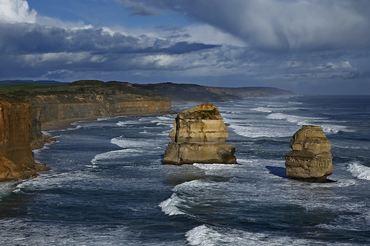 Twelve Apostles 5 km
 Phillip Island 184 km
 Melbourne 186 km
 Kangaroo Island 568 km
 Jervis Bay 783 km
 Sharks Cage diving, Port Lincoln 783 km
|


 JuzaPhoto contains affiliate links from Amazon and Ebay and JuzaPhoto earn a commission in case of purchase through affiliate links.

