Rank : 9.0 (average on 1 votes)Coordinates : 48.400023, -122.659614 (
Open in Google Maps)
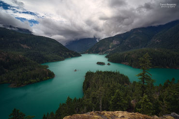
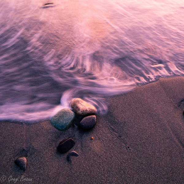
Subjects : Salt water beaches, one facing north, the other west. Deception is a very narrow waterway between Whidbey Island and Fidalgo Island, with very steep sides and a bridge that connects the two. Water flows through the pass at very high rates of speed when the tides change, causing whirpools and standing waves. You can sometimes find kayakers playing in the current. The point that separates North Beach and West Beach is a very rocky outcrop. There are rocks just off-shore that are accessible at low tide, and there are islands farther off-shore. There is lots of driftwood and a very old, gnarled tree at the south end of West Beach.
Recommended equipment : Wide angle lens, tripod, filters (polarizer, neutral density, split neutral density, reverse split neutral density), camping gear, raingear
Best months : Summer months have drier weather. Spring and Fall have variable weather and fog is always a possibility, as it is a marine environment.
How to get there : Head north from Seattle to Mukelteo and take the ferry across to Whidbey Island. Follow Highway 20 north to Deception Pass. From the west side of Puget Sound, head North to Port Townsend and take the ferry across to Whidbey Island and follow Highway 20 north to Deception Pass. Deception Pass may also be reached from the north by taking Highway 20 west from Burlington and then south to Deception Pass.
Visits : You need a Washington State Park Pass for day use or an annual pass.
Notes :
CalendarSunrise: 05:10, Sunset: 21:16
Show Sunrise and Sunset Calendar DiscussionNo replies
Read the discussion Moon Phase🌔 Waxing Gibbous,
Brightness: 81%
Show Moon Phases Calendar 
 JuzaPhoto contains affiliate links from Amazon and Ebay and JuzaPhoto earn a commission in case of purchase through affiliate links.