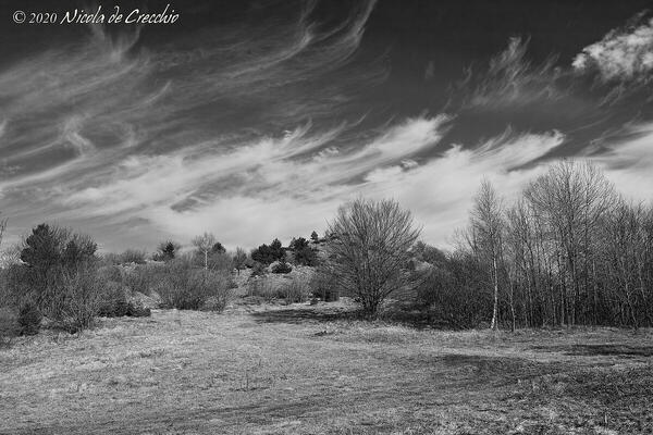
cover photo by
Nicola De Crecchio
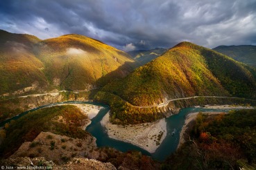
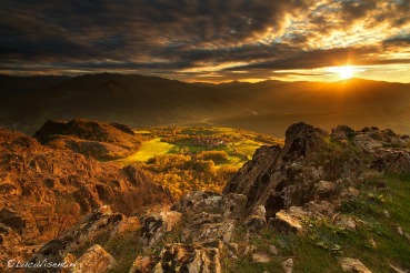
 The information about this location have been automatically translated with Microsoft Translator. The information about this location have been automatically translated with Microsoft Translator. Rank : 8.0 (average on 1 votes)Coordinates : 44.752802, 9.462561 ( Open in Google Maps) Subjects : The Costa del Monte Capra is a long rocky ridge in the extremely scenic Piacentino Apennine; in fact constitutes the watershed between the Trebbia valley and the Perino valley. The achievable photos are therefore landscaped on the surrounding valleys of the Appennine Piacentino. On haze-free days you can also see the Alps distinctly.Recommended equipment : For this place, short focal points are definitely lend and a tripod can be useful for long poses, panoramic shots or shots with different exposures for subsequent fusions. It is useful to have hiking sticks with you to walk safely in the most exposed areas, especially when you have to face the descent.Best months : I believe that all year round he is preparing to visit this place; Every season can certainly offer great ideas. We should not be advised to hike after heavy rains or in case of abundant snow and ice and generally in case of bad weather for the type of route that could become dangerous.How to get there : Walking along the SS 45 of the Trebbia valley you have to reach the village of Perino (PC) and from here continue up to 600m beyond the village of Gavi [fraction of Coli (PC)] where to park. The coordinates to park are as follows: 44.772486, 9.449057. Leaving the car begins the hike on foot. On the right, the CAI 163 sign for the ascent on Mount Gavi begins on the right. for our excursion it is necessary to ignore this signander and take, on the opposite side of the road, a weak path that almost immediately flows into a wide dirt road that takes to the left; after 5-10 minutes you cross a mule track that intersects the main path, it is ignored by continuing straight; After crossing an open and stony area, next to the valley that descends to the right of the track, you return to walk among shrubs and low trees along the dirt road placed in the hollow placed between the parish mountains and Poggio Vaccari. When you reach a further fork you hold the left, always uphill; you continue to climb until you reach an iron gate (to be closed to avoid the dispersion of animals to pasture in the summer season). Less than ten minutes of further decisive ascent lead to a wide plateau. Here you cross the path CAI 151, which runs perpendicular ly the dirt road followed so far, and that you have to take to the right (south). You walk on the earthy path for a couple of minutes until you reach yet another fork: you leave the 151 that continues on the left and turn right uphill along the barbed wire fence, following the indication "159 ridge of Mount Goat". Climb into the beech tree, then the path climbs over the barbed wire and begins to climb between boulders and bushes towards the long rocky ridge, which plummets right towards the Trebbia valley and degrades on the other side, towards the Perino valley. After a few minutes you reach the ridge, on which you continue to walk passing short ups and downs, just below the ridge or right on its sharp top. The route is narrow and exposed, and classified by the CAI "for experienced hikers"; in fact it does not require special mountaineering skills, but requires a lot of prudence, because it is completely devoid of protections. We continue past some spurs of rock of oiland and you reach the top marked by a metal cross. For re-entry you can retrace the route of the round or complete a pleasant loop ride that includes the top of Mount St. Augustine and descends to Maiarda resorts before reimmeters i on the paved road that leads back to the parking point.Visits : Access is free, with no timetables or tickets.Notes :
CalendarSunrise: 05:51, Sunset: 20:46 Show Sunrise and Sunset Calendar DiscussionNo replies Read the discussion Moon Phase🌑 New Moon, Brightness: 0% Show Moon Phases Calendar |
Nearby:  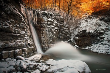 Cascate del Perino 3 km
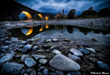 Bobbio 5 km
 Brugnello 7 km
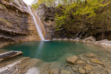 Cascate del Carlone 9 km
 Confiente 9 km
 Pietra Parcellara 10 km
|

 JuzaPhoto contains affiliate links from Amazon and Ebay and JuzaPhoto earn a commission in case of purchase through affiliate links.
