cover photo by
Juza
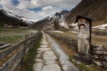
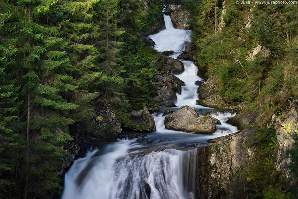
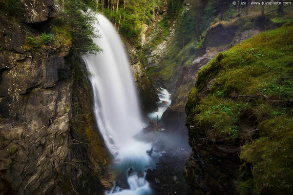
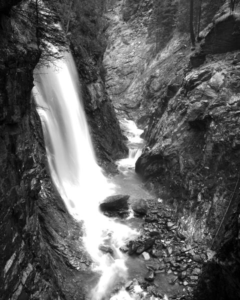
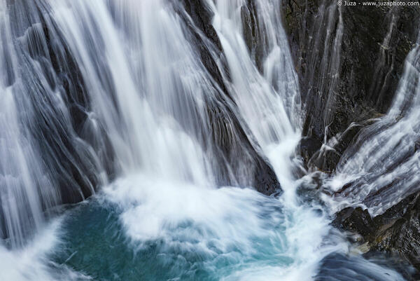
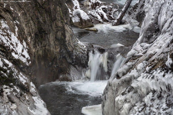
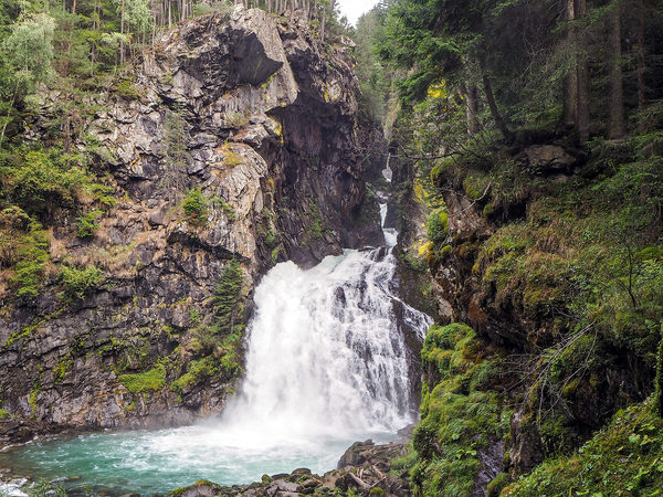
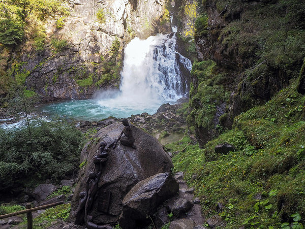
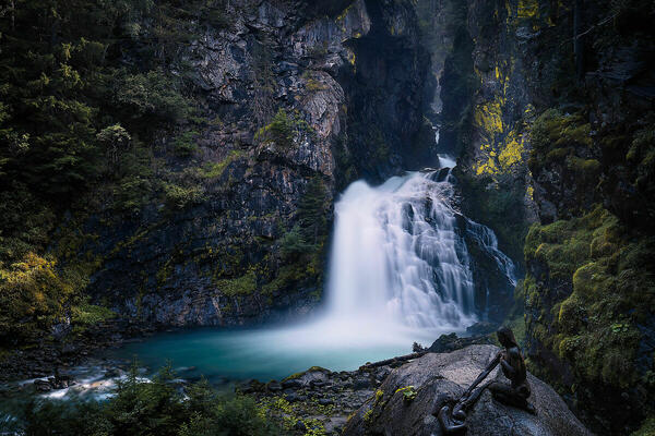
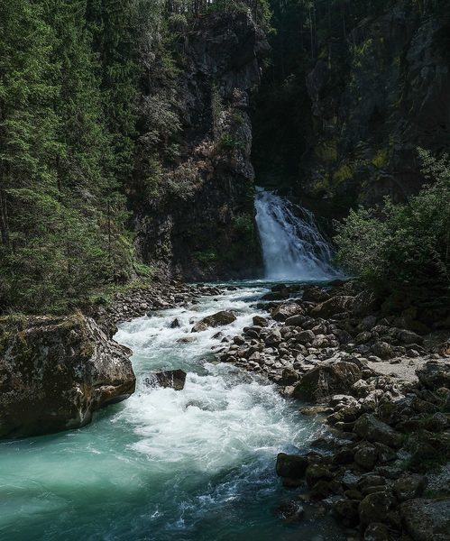
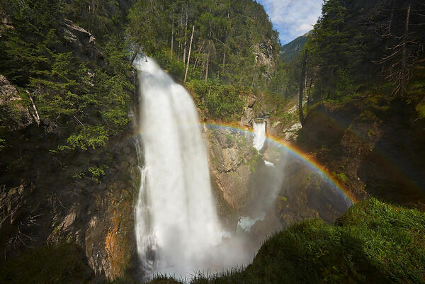
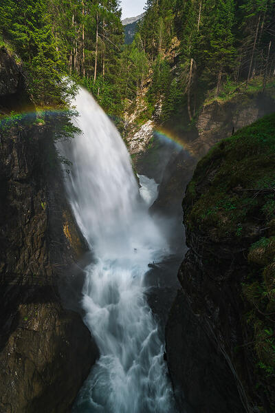
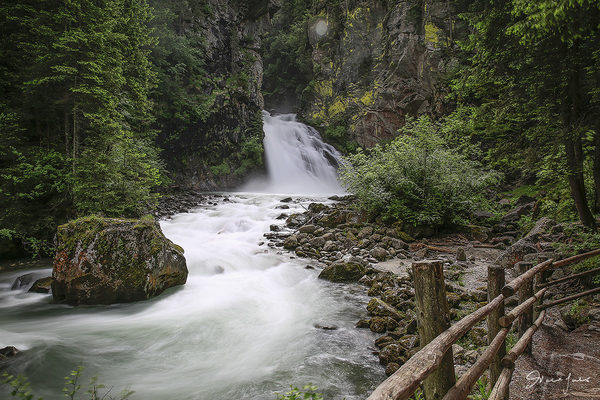
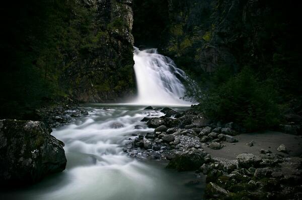
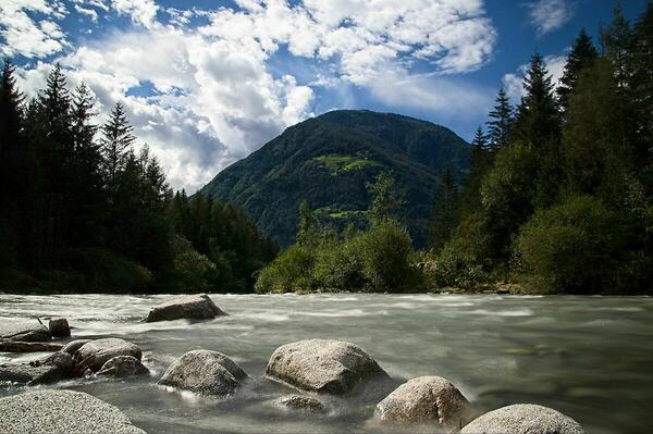
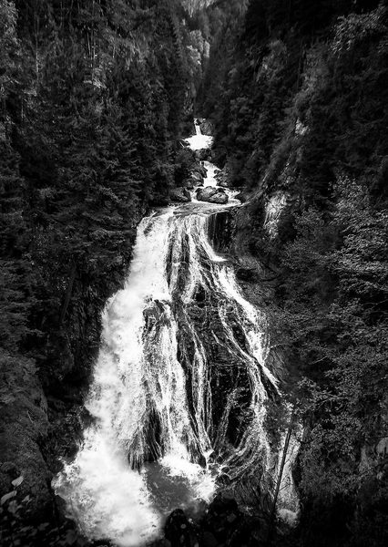
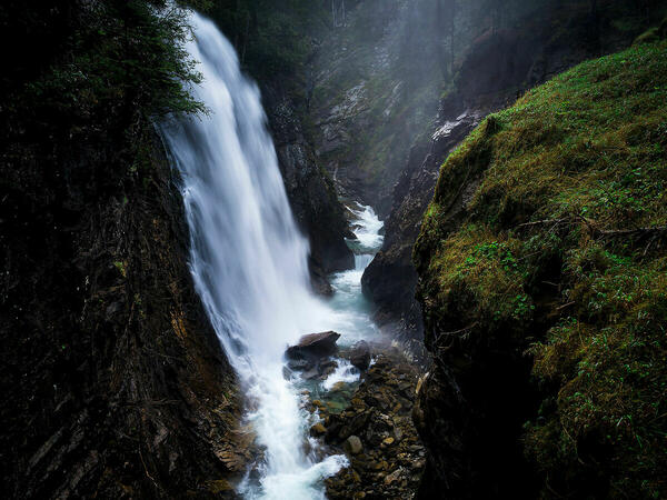
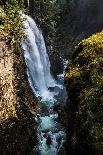
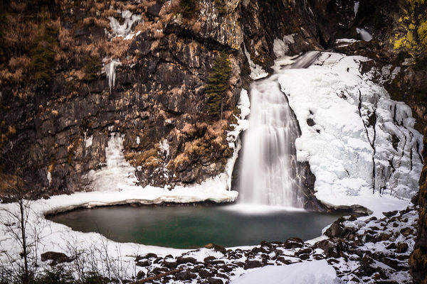
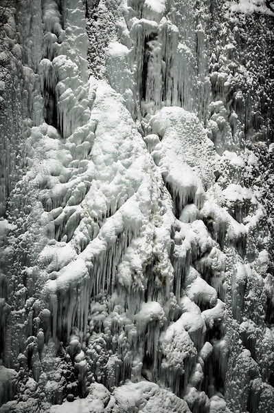
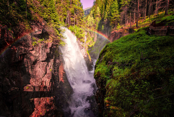
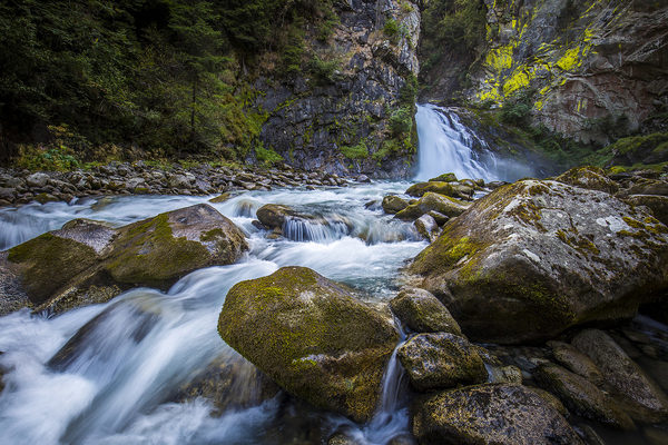
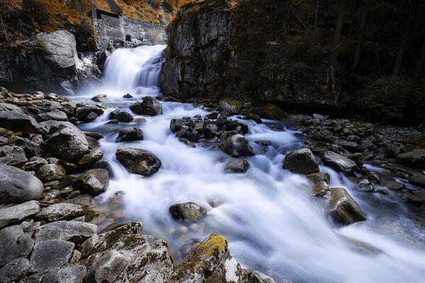
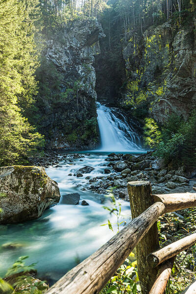
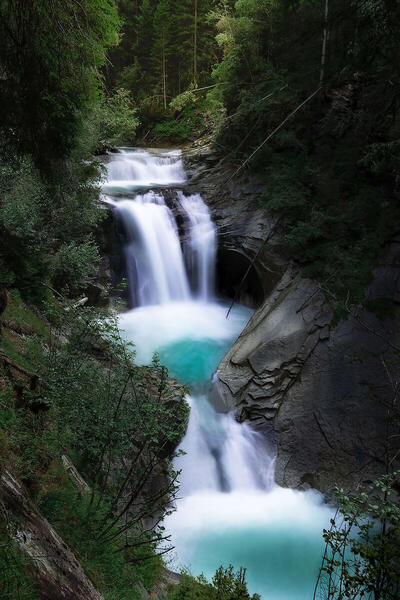
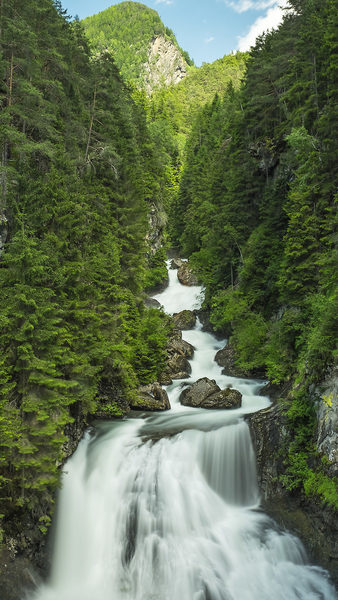
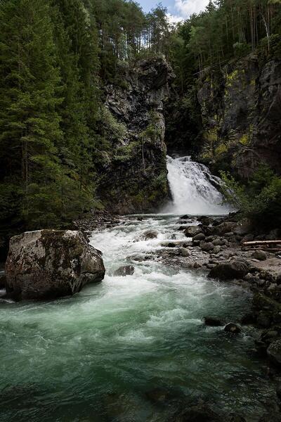
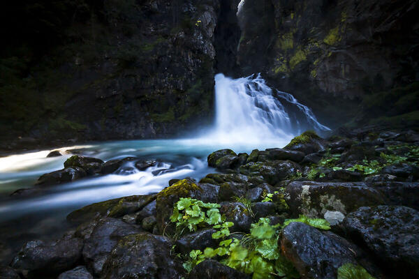
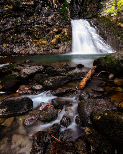
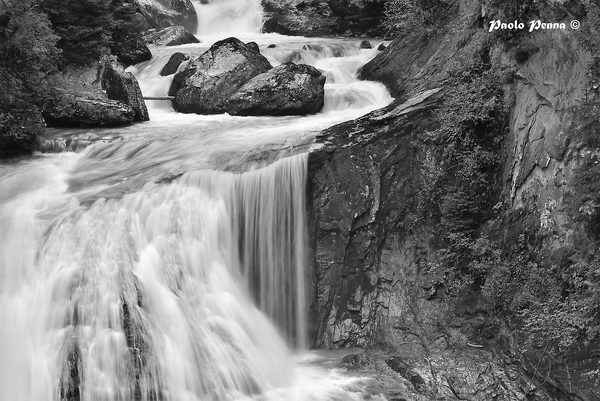
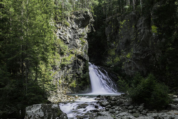
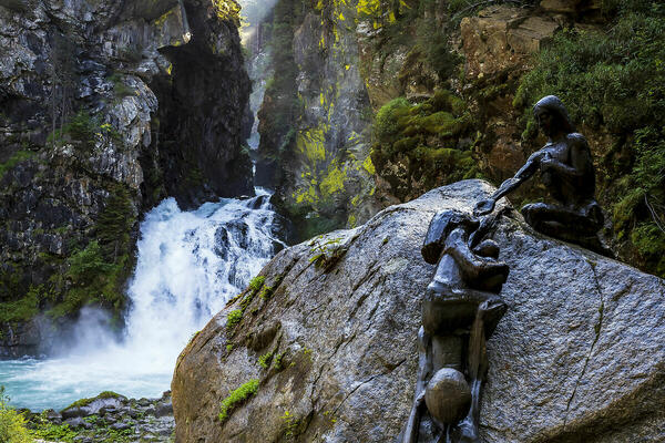
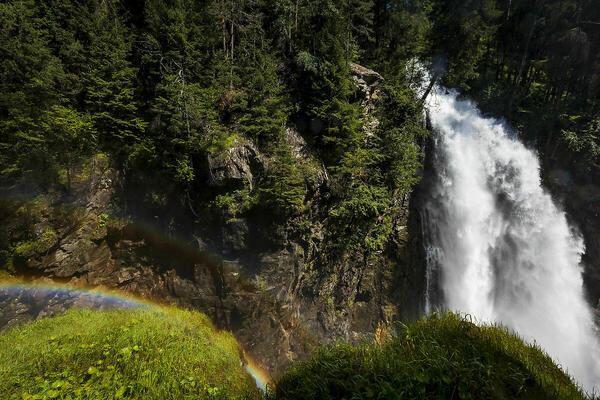
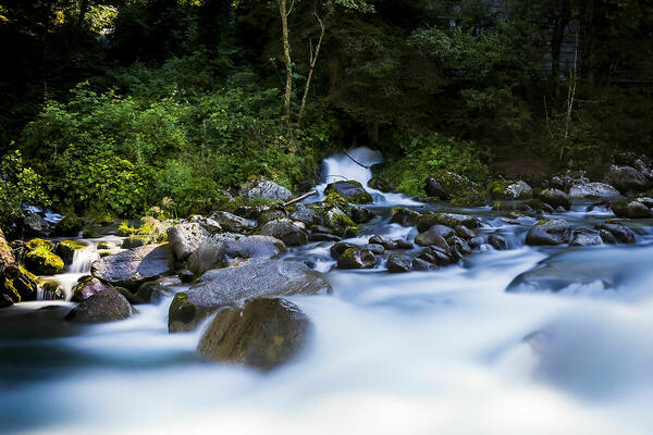
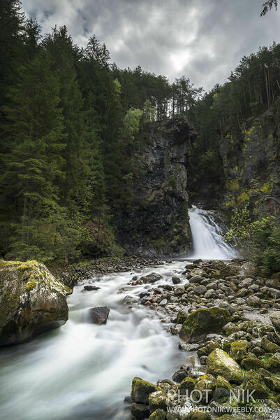
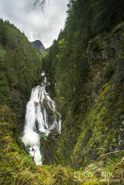
 The information about this location have been automatically translated with Microsoft Translator. The information about this location have been automatically translated with Microsoft Translator. Rank : 9.7 (average on 3 votes)Coordinates : 46.919223, 11.986398 ( Open in Google Maps) Subjects : In spectacular trail in the woods and entirely meet three waterfalls: The first form a small lake, the second in a gorge and the third the most impressive, in winter ice almost completely sculpting a beautiful scultura.Sulla top of the trail also called "Camino San Francesco "is a very impressive church was restoredRecommended equipment : In summer: hiking shoes, hiking gear not impegnativa.In Winter: Mountain equipment, even if there is no snow in the shade being cold it feels. If there is a lot of snow or fresh snow shoes are recommended, but necessary in the backpack of ALWAYS crampons. (There is always ice and downhill you risk) stand, remote control, fixed focal lenses: 14mm, 24mm, 35mm, 50mm. Better zoom: 15-85mm, 18-120mm, 24-105mm, 16-35mm For lovers of silk effects, since the light intensity varies greatly between summer and winter and between morning and afternoon are recommended by an ND filter minimum of 3 stop (ND8) in winter and without the sun to a maximum of 10 stop (ND1000).Best months : Summer: maximum power of acqueAutunno: setting with very suggestiviInverno autumn colors: ice and silk effectsHow to get there : Along the A22 motorway towards Brenner, exit at Bressanone and follow to Val Aurina.Si must come about in Campo Tures, then you will see signs to the falls or San Francesco.Il Footpath trail to the falls of at an altitude of 864 meters above sea level, in the resort bathrooms Cantuccio (Bad Winkel), where there is a parking fee for macchine.Partono two parallel paths and partly overlapping: the path of the falls upstream along the creek and a kind of Stations of the Cross, dedicated to St. Francis of Assisi. Along this second path therefore, there are beautiful wooden sculptures and a few sentences taken from the Canticle of the Sun, hence the name "Path of Saint Francis" .At the end of the series of small sacred niches, the trail ends at the top with a small church in granite, which belonged to the now non-existent castle Toblburg to 1,172 meters. To walk the path (round trip) at least 2 hours are required.Visits : Input Libero.Si only pay parking: € 3 daily.Notes : Time needed: at least 2 hours and 30. Arrival / Ritorno.Dislivello: 238mt.da 864mt. 1.172mt in. (the church) .The third waterfall is first, at about 1,100 meters.
CalendarSunrise: 05:17, Sunset: 21:10 Show Sunrise and Sunset Calendar DiscussionNo replies Read the discussion Moon Phase🌓 First Quarter, Brightness: 45% Show Moon Phases Calendar |
Nearby:  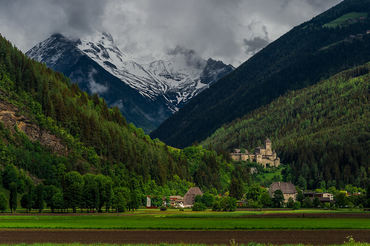 Val di Tures 2 km
 Parco Naturale Vedrette di Ries-Aurina 7 km
 Valle di Anterselva 13 km
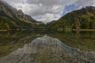 Lago di Anterselva 14 km
 Brunico 14 km
 Alta Badia 24 km
|


 JuzaPhoto contains affiliate links from Amazon and Ebay and JuzaPhoto earn a commission in case of purchase through affiliate links.