Rank : 8.7 (average on 3 votes)Coordinates : 17.956362, -67.207961 (
Open in Google Maps)
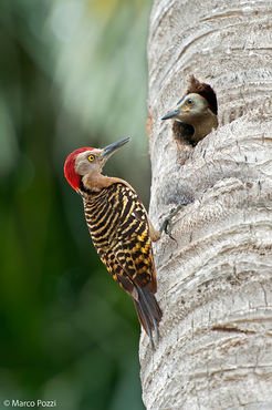
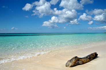
Subjects : birds; insects. Cabo Rojo is home to amazing beach coves including a Blue Flag Beach, Los Morrillos Lighthouse natural park undeniably the most scenic attraction on the island, 587 acres of subtropical dry forest, natural arches, educational attractions for the whole family such as the Salt Flats, caves that Real Pirates of the Caribbean used as hideouts, many activities for eco travelers and adventure seekers, marinas, the best fishing on the island, the freshest seafood, warm colorful sunsets and super friendly locals.
Recommended equipment : telefoto; macro lenses; tripod. Very sunny location all year... be ready for it
Best months : all year, specially in US winter months
How to get there : From the San Juan Airport:
Directions: Approximate driving time: 2.5 hours, 125 miles, by Mapquest
The ride is very scenic and there are plenty of places along the way with great food and shopping. The highway is modern, safe with good signs. It's actually a very enjoyable drive.
Start out going southeast on Avenida Jose a Tony Santana toward PR-190,
Turn right onto PR-190, Take the PR-26 W ramp, Merge onto PR-26 O/Expreso Román Baldorioty de Castro. (5.2 miles), Merge onto PR-18 S/PR-22 O/Autopista José de Diego toward Bayamó Caguasío Piedras. (1.5 miles), Keep left to take PR-18 S via EXIT 2A toward Río Piedras/Cupey/Caguas. (4.1 miles), R-18 S becomes PR-52 S (Portions toll). (67 miles), Merge onto PR-2 O via the exit on the left toward Mayagüez/Guayanilla. (39.8 miles), Merge onto PR-100 via EXIT 161 toward Cabo Rojo. (4.8 miles)
Visits : No fees; free entry; interpretative office open from 9AM to 5PM
Notes :
CalendarSunrise: 05:55, Sunset: 19:07
Show Sunrise and Sunset Calendar DiscussionNo replies
Read the discussion Moon Phase🌔 Waxing Gibbous,
Brightness: 76%
Show Moon Phases Calendar 
 JuzaPhoto contains affiliate links from Amazon and Ebay and JuzaPhoto earn a commission in case of purchase through affiliate links.