RCE Foto

(i) On JuzaPhoto, please disable adblockers (let's see why!)


Login LogoutJoin JuzaPhoto!
JuzaPhoto uses technical cookies and third-part cookies to provide the service and to make possible login, choice of background color and other settings (click here for more info).

By continuing to browse the site you confirm that you have read your options regarding cookies and that you have read and accepted the Terms of service and Privacy.


OK, I confirm


You can change in every moment your cookies preferences from the page Cookie Preferences, that can be reached from every page of the website with the link that you find at the bottom of the page; you can also set your preferences directly here

Accept CookiesCustomizeRefuse Cookies

Altopiano dei Tredici Laghi, Italy


cover photo by Bruno87  


Location added by Bruno87


 The information about this location have been automatically translated with Microsoft Translator.

Rank : 9.0 (average on 2 votes)

If you know this place, give your vote:  

Coordinates : 44.862221, 7.081434 (Open in Google Maps)

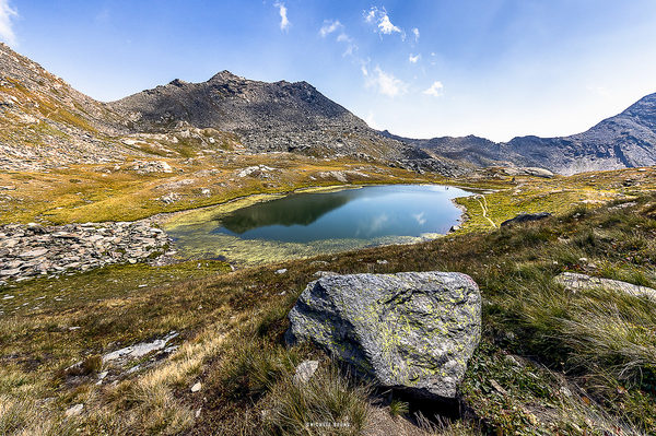
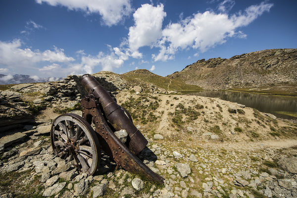
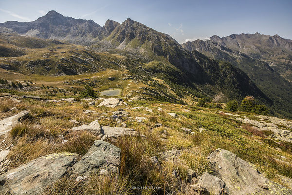
Subjects : The Vallone dei 13 lakes offers the possibility of photographing mainly mountain landscapes but also local flora and fauna. For fans of historical-military testimonies there are two shelters dedicated to Giuseppe Domenico Perrucchetti (considered the father of the military body of the Alpini), some abandoned barracks, the old military routes that go up the slopes of the valley and near the lake Ramella are located still two cannon barrels.The lakes still visible are eleven or twelve depending on the season and are: the Black Lake, the White Lake, the Drajo Lake, the Lake of Man, the Twin Lakes, the Primo Lake, the Lake Along, the Lago Ramella (or Lago dei Cannoni), the Green Lakes and the Lago della Noce that is formed only during the period of the thaw. The thirteenth is the Lake of Carrot which is now completely underground.

Recommended equipment : definitely recommend to take a wide angle for landscape photos, a nice telephoto lens to capture distant glimpses far away to reach or some animal (if you're lucky) and for lovers of flower photos a nice macro is fine.

Best months : the summer period is the best for excursions in the valley and surroundings

How to get there : From Turin take the A55 to Pinerolo, from here continue on the SP23R to Perosa Argentina where you will meet the signs for Prali. Going back to the Germanasca Valley, once you reach Prali, continue along the Ghigo hamlet, following the state road up to the large parking lot in front of the chair lift. From here you can decide whether to climb with a nice walk or if you are to be brought to an altitude of 2400 m from the chairlift.

Visits : To pay there is only the ticket for the two sections of the chairlift.

Notes :


Calendar

Sunrise: 06:27, Sunset: 20:31

Show Sunrise and Sunset Calendar
Discussion

No replies

Read the discussion
Moon Phase

🌖 Waning Gibbous, Brightness: 94%

Show Moon Phases Calendar
Nearby:

Destinazione
Ruata di Pramollo
11 km
Destinazione
Val Troncea
15 km
Destinazione
Valle Argentera
18 km
Destinazione
Lago Fiorenza
18 km
Destinazione
Pian del Re
18 km
Destinazione
Forte di Fenestrelle
19 km


Photos taken at Altopiano dei Tredici Laghi


Sort by popularitySort by date

Foto
Valley of the Thirteen Lakes
by Bruno87
10 comments, 1639 views  [retina]
Foto
Cannon to the thirteen lakes
by Bruno87
2 comments, 670 views  [retina]
Foto
Valley of the Thirteen Lakes
by Bruno87
2 comments, 684 views  [retina]


More » Locations » Italy » Altopiano dei Tredici Laghi


 ^

JuzaPhoto contains affiliate links from Amazon and Ebay and JuzaPhoto earn a commission in case of purchase through affiliate links.

Mobile Version - juza.ea@gmail.com - Terms of use and Privacy - Cookie Preferences - P. IVA 01501900334 - REA 167997- PEC juzaphoto@pec.it

May Beauty Be Everywhere Around Me