cover photo by
MarcoVeronese76
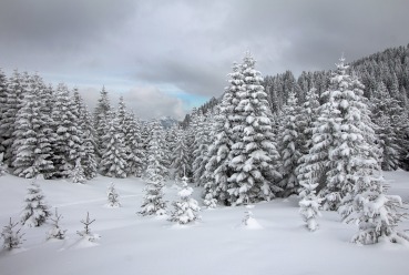
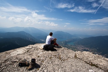
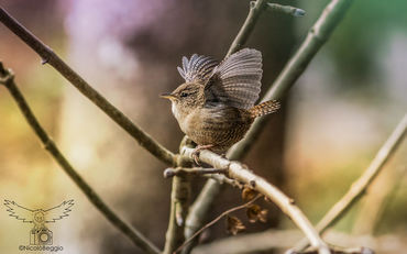
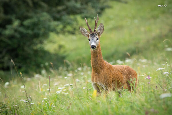
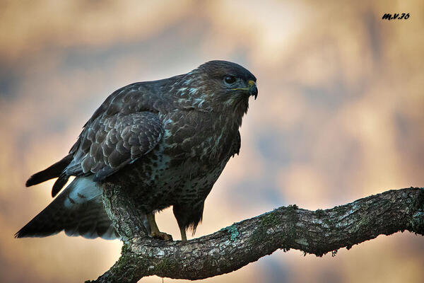
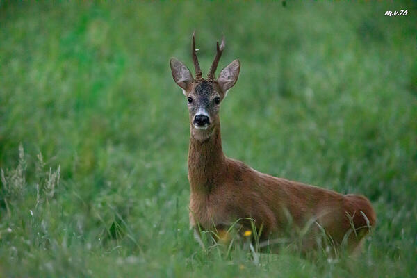
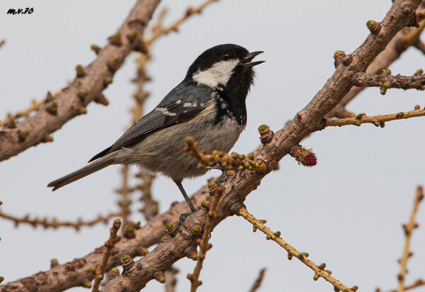
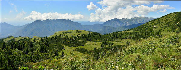
 The information about this location have been automatically translated with Microsoft Translator. The information about this location have been automatically translated with Microsoft Translator. Rank : 8.0 (average on 1 votes)Coordinates : 45.917727, 11.220227 ( Open in Google Maps) Subjects : Malghe, woods, mountains with a wavy profile, villages, wild animals (roe deer, chamois, hares, birds of prey) and domesticated (cattle, sheep), ruins and testimonies of the Great War (strong, trenches, museums).Recommended equipment : The usual one for nature photos. A wide angle is certainly very useful for resuming the war works of the Great WarBest months : Autumn and winter, but also late spring with the flowering of pastures, and summer for the variety and contrast of the lights, at least on partially clouded days.How to get there : From the Trentino side: Getting to Folgaria, an important tourist centre; take the road to Carbonare-Lavarone-Vicence. After a few km, at the High Pass, take to the right the road to Fiorentini-Tonezza del Cimone. From the Vicentino side: Get to Tonezza, with the road that rises from Arsiero, and continue, without detours, to the road of the Florentines. Visits : All free, only limitations those of the fences of pastures for animals.Notes : Quiet, pleasant place, with several hiking options (walking or MTB), and less frequented than other more "famous" resorts. It is not very extensive, however you will find a decent offer of hospitality. The most important and comfortable resorts for tourist support are Tonezza del Cimone, Carbonare, Folgaria, Lastebasse. More on:https://www.skiforum.it/resorts/Florentine-costa-d-agra-step-coe/index.htmlhttps://www.magicoveneto.it/Altipian/Tonezza/Excursions-Walks-Walks-Shelters-Tone-Coe-Fiorentini.html
CalendarSunrise: 05:51, Sunset: 20:31 Show Sunrise and Sunset Calendar DiscussionNo replies Read the discussion Moon Phase🌗 Third Quarter, Brightness: 66% Show Moon Phases Calendar |
Nearby:  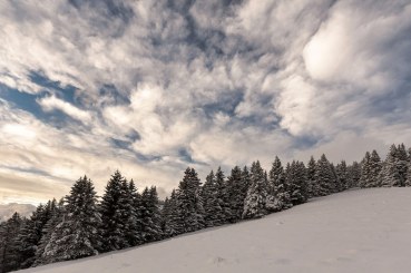 Folgaria 3 km
 Passo Coe 4 km
 Castel Beseno 8 km
 Lago di Levico 11 km
 Cima Vezzena 11 km
 Tonezza Del Cimone 12 km
|

 JuzaPhoto contains affiliate links from Amazon and Ebay and JuzaPhoto earn a commission in case of purchase through affiliate links.
