Rank : 9.0 (average on 1 votes)Coordinates : 43.466409, -7.726062 (
Open in Google Maps)
Subjects : Municipality of the interior of the province of Lugo with hiking trails of medium difficulty.In the landscape lies the main attraction of the beautiful municipality of Muras in which we can highlight the existence of two protected natural areas: the Serra do Xistral, at the eastern end, and the banks of the River Sor in the western sector. The river network is represented by Eume, Landro and Sor. A beautiful river area is the Eume river as it passes through the municipal capital, located on the other side of the C-640 road and around which a rest area and a beach have been built.There are several Archaeological Vestigios found in these lands, among them the Castro de Picheira, Castro de Paredes and Carrusco in Sixto; Castro Sol; Farms of Medoña in Tower; Campo da Forca in Silan; Castrillón, Lusana and Campo da Feira de Viveiró and to Fraga do Castro in Burgo. The religious heritage is also very extensive with several churches such as the one of San Pedro, constructed in 1678 that conserves in its interior an interesting silver cross of principles of century XVII. The bell tower, located 100 meters from the church is from 1846. Interesting is also the church of O Burgo, with baroque neoclassical altarpieces. The one of Santa Maria of Balsa of the centuries XII and XIII, conserves gothic and Renaissance elements.Port of La Gañidoira. The port of La Gañidoira (in Galician: Porto da Gañidoira), also known as Alto da Gañidoira, is a mountain port of 720 meters altitude, located in the municipality of Muras (Lugo province), being the passage of the road LU-540 to cross the Sierra del Gistral.The Xistral mountain rangeTo access the Serra do Xistral, we have to leave the C-640 road and head east to the Guriscado and Curruxeira mountain ranges that lead to Viveiro. It is frequent to find beautiful wild horses in full freedom, because there is in this area a large equine hut in semi-wild state. Once past the nucleus of Viveiro and in the direction of Silan, the landscape becomes more leafy and the high course of the Landro river offers us beautiful places in the middle of a lush vegetation, typical of the interior Galicia, with predominance of oak, chestnut and birch, and large areas repopulated with pines. The fauna is composed of birds of prey such as the hawk and the snake. Among the mammals include the wolf, the boar, the fox and the roe deer. Among the reptiles it is worth mentioning the presence of the meager peat lizard that is only found here and in Os Ancares.
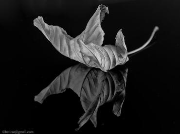
Recommended equipment : To make landscape photography, flora and fauna, I recommend macro, angular and telephoto lenses.
Best months : The climate is mild, and generally warm and temperate. There is more precipitation in winter than in summer. The climate is classified as Csb by the Köppen-Geiger system. The temperature here is on average 11.7 ° C. In a year, the average rainfall is 1149 mm.The best seasons for photography would be in autumn, winter and spring.
How to get there : Using the airports of Alvedro in Santiago de Compostela and the one of Lavacolla in A Coruña, by highway A-9 to the municipality of Pontedeume in the exit 21-F by the AC-564 and next one takes the Ag-64 and in Cabreiros the road LU-540. Approximate time one hour 30 minutes
Visits : There is no restriction to visit Muras, A Gañidoira and Serra do Xistral
Notes : 

 JuzaPhoto contains affiliate links from Amazon and Ebay and JuzaPhoto earn a commission in case of purchase through affiliate links.